
Africa: the UN votes to ‘correct’ geographical maps, infuriating the US
The assembly has given the go-ahead to a resolution to revise the Mercator-era maps and reflect the continent’s actual dimensions
from our correspondent Alberto Magnani
 Aggiungi Il Sole 24 Ore
ai preferiti su Google
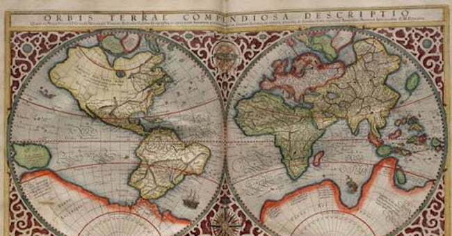
NAIROBI – On 4 September, the UN General Assembly gave the go-ahead to a resolution to ‘correct’ world maps and depict the size of Africa more accurately, as it is currently underrepresented in the old Mercator projection.
The text, entitled ‘Correct the Map’, was tabled by the Togolese government on behalf of the African Group at the UN and received 164 votes in favour, six abstentions (Estonia, Georgia, Lithuania, Moldova, Serbia, Ukraine) and a single ‘no’ vote: that of the United States, which was furious at a text accused of ‘ridiculing’ the institution.
“Instead of focusing on real issues of international peace, prosperity or good relations,” stated the US Mission, “this body is debating 16th-century cartographic maps and their role in promoting compensation for historical wrongs.” Washington’s reference is to yet another UN resolution calling for recognition of and compensation for damages arising from the slave trade, once again opposed by the United States.
The ‘distortion’ of Africa
The dispute is a long-standing one, but the debate has gathered pace in recent years. The battle for a map update has resulted in a petition on Change.org against the ‘distortions’ in the maps and in favour of a more ‘fair’ representation of sizes, launched in early 2025 and which has now surpassed 12,000 signatures. The African Union, the organisation comprising 55 countries on the continent, endorsed the cause in August of that same year and called on the Togolese government to take the lead in adopting the text that had just been approved in New York.
The projection created in 1569 by Gerardus Mercator, the Flemish mathematician after whom the map is named, is criticised for making Africa appear – significantly – smaller and for exaggerating the size of other regions. This distortion stems from the difficulty of accurately representing the globe on a two-dimensional map and the resulting compromises. Mercator’s map adapts to the curvature of the Earth and remains a standard for maritime navigation, but it has the effect of making countries near the equator appear smaller and those near the poles appear larger.


