
AlphaEarth, Google's Ai that maps the Earth with unprecedented accuracy
Available for free through Google Earth Engine for researchers and organisations, it is the new frontier of global maps according to DeepMind
3' min read
3' min read
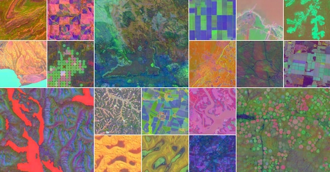
Google DeepMind has just unveiled AlphaEarth Foundations, an artificial intelligence model that functions as a 'virtual satellite', capable of mapping the entire planet with an accuracy of up to 10 by 10 metres. The system processes petabytes of Earth observation data from multimodal sources, including optical satellites such as Sentinel 2 and Landsat, synthetic aperture radar (SAR), 3D lidar surveys, climate models, elevation data and even georeferenced text. All this information is merged into a coherent digital representation of the planet, made available through the Satellite Embedding dataset on Google Earth Engine.
The annual dataset is ready to use, distributed under an open source licence (Apache 2.0) and accompanied by tutorials and a grant programme of up to $5,000 for scientific applications. Unlike many previous solutions, it does not require complex pre-processing steps (such as cloud masking or atmospheric correction), and thus provides more immediate and cost-effective access to advanced Earth observation capabilities. In this way, technologies hitherto reserved for large research centres or companies with significant computational resources also become accessible to local authorities, start-ups, NGOs and universities.

The numbers of the new application
.AlphaEarth is not a satellite, but it acts as one. The system interprets dozens of heterogeneous sources - optical, radar, elevation, meteorological and textual data - and merges them into a single numerical representation, called 'embedding', which condenses the information collected over an entire year into a 64-dimensional vector space. It is like translating the appearance, function and composition of every square metre of the Earth into a machine-readable formula. This not only reduces the space needed to store the data, but also improves its quality. Tests show a 24% reduction in average error compared to previous approaches, with superior performance even in complex conditions such as the Amazon, the Sahel or Antarctica.
The result is a drastic reduction (sixteen times less) in storage space. Translated into economic terms, this means a clear reduction in costs for geospatial analysis on a planetary scale, a crucial factor in making accessible technologies that until recently were reserved for large companies and research centres. The system analyses the planet's land surfaces and coastal waters by dividing them into 10×10 metre squares, and allows changes over time to be tracked with an extraordinary level of detail. Each pixel, in other words, covers an area smaller than a football field, enough to monitor individual city blocks or small agricultural plots.
The dataset generated by AlphaEarth is among the largest of its kind ever produced: over 1.4 trillion geospatial embeddings per year. The system does not just provide images: it transforms raw data into operational intelligence, also enabling predictive modelling of environmental changes.

