
Italy increasingly vulnerable: areas at risk of instability grow by 15%
In the Ispra report, the landslide danger affects 23% of the territory, 70,000 square kilometres. Hydro-meteorological events judged to be of exceptional intensity, but also the increase in monitoring
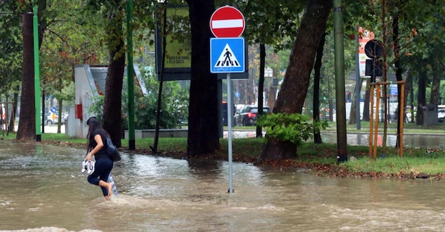
Milan under water from the Seveso river, mud in Como, the Bormida river flooded in Piedmont. This is the chronicle of Monday 22 September in some areas of the country, three, partial, frames of an autumn that began by confirming the dramatic evidence of the fragility of our territory. Images that go in the wake of a three-year period, the 2022- 2024 period, which as the fourth 'Ispra Report on Hydrogeological Desertification in Italy' (2024 edition) reconstructs "has been marked by hydro-meteorological events of exceptional intensity".
Events such as 'the widespread flooding along the main and secondary river courses in the Marche region in September 2022, the rapid mud and debris flows on the island of Ischia in November 2022 with 12 deaths, the floods in Emilia-Romagna in May 2023, with damage estimated at8.6 billion euro, and the intense rainfall in Valle d'Aosta and northern Piedmont in June 2024', the researchers reconstruct.
The risk of landslides is growing
.The result is a 15% increase in the area of Italian territory endangered by the presence of landslides. In absolute terms, this will rise from 60,481 square kilometres in 2021 to 69,553 square kilometres in 2024, equivalent to 23% of the national territory. More in detail, the areas classified as most dangerous (in technical terms 'high P3' and 'very high P4') increased from 8.7% to 9.5% of the national territory. The most significant increases were in the Autonomous Province of Bolzano (+61.2%), Tuscany (+52.8%), Sardinia (+29.4%) and Sicily (+20.2%). This, however, is not necessarily a negative figure due, the Ispra report clarifies, "to more detailed studies carried out by the District Basin Authorities and the Autonomous Provinces".
The result is a composite picture with two keys to interpretation, as Alessandro Trigila, head of the Development and Coordination Section of Ispra's Inventory of Landslide Phenomena in Italy and In Situ Monitoring of Landslides, explains. "Compared to the last report, which stopped at 2021, in the three-year period 2022-2024 there have been further studies," he says, "that have urged an improvement in the cognitive framework. At the same time, in these three years there have also been a whole series of particularly critical events on the national territory, both with regard to floods and landslides, which have led to the modification of the danger maps".
In the dock, the researchers have no doubts, are climate change, which triggers 'an increase in the frequency of intense and concentrated rainfall, with a consequent increase in surface landslides, rapid mud and debris flows, and floods, including flash floods (rapid and sudden floods), amplifying the risk with impacts even on historically less exposed territories'. An example? 'In 2023,' says Trigila, 'in May in the hinterland of Emilia-Romagna we had over 80 thousand landslides, which is an extraordinarily high number. Just consider that we usually talk about one thousand landslides, at most three thousand, in a year throughout Italy'.

