
Oceans: mapping the seabed sparks geopolitical disputes
In the Arctic, the surveying activities carried out by various countries have direct implications for sovereignty

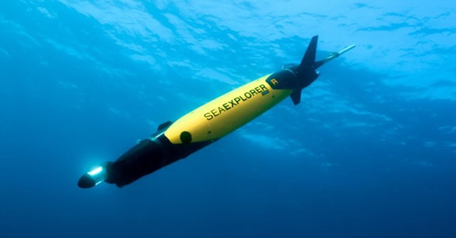
The major powers, on the hunt for precious polymetallic nodules, are already at the forefront of deep-sea mining, but the ocean floor remains uncharted territory for us humans. It sounds like a joke to say that we know the surface of Mars better, but it’s true: robotic probes have photographed the entire surface of the Red Planet with sufficient resolution to track changes in individual sand dunes from one season to the next, whilst less than a third of the world’s ocean floor has been mapped to modern standards.
Areas not yet mapped
Over the last decade, the Seabed 2030 project has increased global bathymetric mapping from 6 per cent to 28.7 per cent, but the overall figure can be misleading in both directions. It underestimates the progress made in areas of heavy traffic: the North Atlantic, the Mediterranean and the coastal waters of the wealthiest maritime nations are now largely mapped. Conversely, it overestimates the global picture. The 71 per cent that remains unmapped, in fact, consists of extremely deep, remote and hard-to-reach areas. It therefore remains highly unlikely that the initial target of completing the mapping by 2030 will be met, despite the acceleration in progress.
The use of technologies
This acceleration is the result of a number of recent developments. Multibeam sonar technology has improved and become more widely used, including on vessels not specifically designed for seabed mapping – such as commercial ships, ferries and research vessels – which can now provide data passively whilst underway. Over 185 organisations from more than 40 countries have contributed to the global GBCO (General Bathymetric Chart of the Oceans) grid, which forms the basis for the results of the Seabed 2030 project. Furthermore, machine learning is playing an increasingly important role in data processing, enabling depth information to be extracted more quickly from raw sonar signals and allowing gaps between different survey lines to be filled in more sophisticated ways.
The result is a coverage rate which, to date, has stood at several million square kilometres per year. The fact remains that the abyssal plains of the South Pacific, the deep basins of the Indian Ocean and the polar waters covered by seasonal ice present survey environments that are logistically very complex, particularly for a public project funded mainly by philanthropic organisations, starting with the Nippon Foundation, which launched it.
Russia and China’s moves
It is precisely in these particularly challenging areas that the most contentious governments – starting with China and Russia – are taking action. Seabed mapping, in fact, is not politically neutral. Under the United Nations Convention on the Law of the Sea, a coastal state’s rights over the continental shelf may extend beyond the standard exclusive economic zone of 200 nautical miles, provided the state can demonstrate that the continental shelf extends beyond that limit. Bathymetric data and geological surveys play a fundamental role in these matters.

