
Serco launches a platform for processing satellite data for public authorities and businesses
NadirEO enables a range of solutions to be catalogued. The sectors it focuses on are: energy, insurance, infrastructure and agriculture

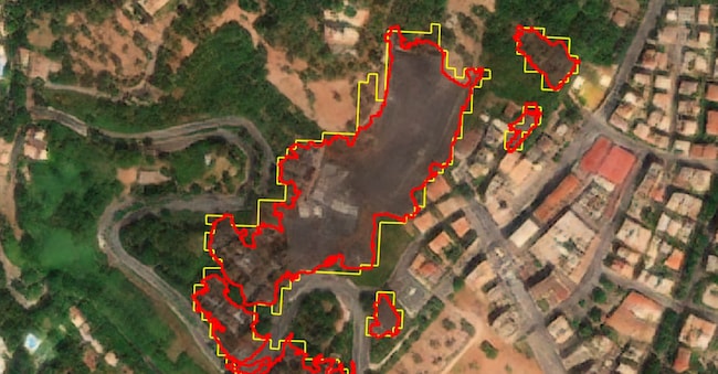
Serco has launched NadirEO, a platform that transforms Earth observation data into ready-to-use analyses for businesses and public authorities. Unveiled at the first edition of Bex-Beyond Exploration Expo, NadirEO launches with 18 services provided by an ecosystem of specialist partners (including Geoskop and the Italian firms Titan4 and Gisky) and is initially targeting four sectors: energy, insurance, infrastructure and agriculture.
The Serco Group, with over 50,000 employees worldwide and more than 6,000 across ten European countries, including Italia, has been working on the continent’s space programmes for over forty years; through NadirEO, it aims to sell that expertise to businesses in the form of a service. The idea is simple: instead of buying satellite imagery and hiring staff to analyse it, you can access a catalogue of ready-made solutions. How vulnerable is a factory to flooding? Where is vegetation growing too close to a power line? What is the fire risk in a particular area? These are the use cases highlighted by Serco and designed for those without remote sensing expertise.
“What sets this apart isn’t just the technology,” explains Roberto Mulatti, managing director of Space Europe and CEO of Serco Italia, “today, an organisation can either rely on a single supplier, accepting its limitations, or commission a bespoke system, which involves higher costs and longer lead times. NadirEO offers a third way: an open and collaborative ecosystem, where data providers, developers and integrators combine complementary services, with each party focusing on how to create value for their own users.”
Behind the scenes, the platform cross-references data from public and commercial satellites, aircraft, drones and ground-based sensors with the client company’s archives; it also queries this data using natural language thanks to AI, and returns each result with full traceability: which sources were used, when the data was acquired, and how it was processed.
The key issue for a business remains the cost. Payment is on a pay-as-you-go basis, and customisations are quoted separately. The price depends on the service and the area covered: updating a natural risk analysis for assets and infrastructure in a region covering over 10,000 square kilometres costs approximately 12,000 euros. An initial analysis takes anywhere from a few hours to several days, depending on its complexity.

