
Weather alert: Icelandic cyclone on its way, here are the most affected regions
The weather alert has been issued for 9 Italian regions due to the arrival of an Icelandic cyclone that will bring rain and a drop in temperatures

2' min read
2' min read
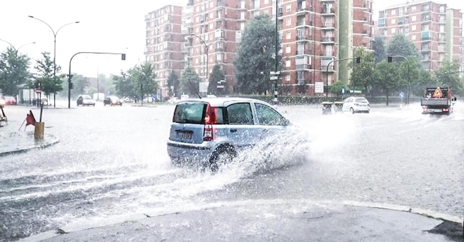
Rain and plunging temperatures: until Friday, the weather alert will be triggered throughout Italy where, in some regions, parks or areas at risk will be closed. The good weather has its hours counted, because, as the www.ilmeteo.it, an Icelandic cyclone will reach the Gulf of Lion towards evening and then our country bringing bad weather, a drop in temperatures;
The focus on the North West
.The most affected areas, initially, will be those in the northwest. According to the site's forecasts, 'rainfall in excess of 150 mm is expected in 24 hours between Lombardy and Piedmont, and accumulations in excess of the rainfall that has fallen throughout the summer in some of these areas of the country cannot be ruled out'. Not even the Tyrrhenian side will be immune from the effects of the bad weather, where scattered showers are expected to alternate with stable, sunny phases. The Adriatic side is more sheltered, where there will still be isolated showers.
Yellow alert between Liguria and Campania
The alert is for tomorrow Thursday when there could be cloudbursts. Maximum attention on Liguria where Arpal has issued a yellow alert (the lowest) for thunderstorms in the regional territory starting from 9 pm this evening and until 2 pm tomorrow. During the overnight hours, the arrival of the disturbance is expected which may cause "rainfall over the entire region of up to heavy intensity and up to high accumulations; the rainfall will mainly persist in the Centre and Ponente and will extend to the Levante during the morning. Until early afternoon tomorrow, "strong instability is expected with a high probability of strong thunderstorms in all areas. Attention also in Lombardy, in the north-west in general and between Tuscany and Lazio. Alert also in Emilia Romagna and in Triveneto.
From midnight today until midnight tomorrow, Thursday 5, the weather alert (yellow) number 112, for thunderstorms, issued by the Regional Civil Protection Agency and Arpae Emilia-Romagna, will be active in the territory of the municipality of Ravenna;
Closed Beaches
The same applies in Campania, where, following the yellow weather alert issued by the Campania Civil Protection for adverse weather phenomena expected from 6 a.m. on Thursday 5 September until 6 a.m. on Friday 6 September 2024. In this case, the city parks and the northern pier of Bagnoli will be closed for the duration of the alert and access to the city's public beaches will be prohibited.

