
An Atlantic weather system is on its way; from tomorrow, there will be rain – some of it heavy – and thunderstorms
Between Tuesday 20 and Wednesday 21 October, the arrival of a very extensive Atlantic weather system will bring widespread rainfall across much of the country.

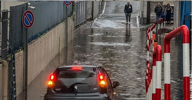
The new week will mark a marked change of pace compared with previous days, bringing a decidedly more dynamic and distinctly autumnal scenario, particularly in the first half. The advance of westerly currents will facilitate the arrival of a well-organised weather system heading towards the Mediterranean basin. Federico Brescia, a meteorologist at iLMeteo.it, explains that today, Monday 19 October, conditions of marked instability will persist in the north-west, with locally intense weather affecting, first and foremost, western Liguria. Between Tuesday 20 and Wednesday 21 October, the arrival of a very extensive Atlantic weather system will bring widespread rainfall across much of the country.
Heavy rain expected in Liguria and Piedmont
The north-western regions, and in particular Liguria and Piedmont, will experience continuous and heavy rain. By Wednesday afternoon, total rainfall could exceed 100–150 mm in the Savona area. As the weather front moves in, rainfall will spread to almost the whole of the country by Wednesday afternoon.
Particular attention should be paid to the areas along the Tyrrhenian coast, particularly Tuscany and Lazio, which are traditionally more exposed to this type of Atlantic weather pattern. From Wednesday, winds will shift to westerly and south-westerly directions: strong south-westerly winds blowing at over 40 km/h may cause storm surges along the exposed coasts of Liguria and Tuscany, with waves up to 3–4 metres high. From Thursday, following the passage of the weather system, minimum temperatures are expected to fall by around 2–4°C.

