Climate change

Intense heat until mid-August, with a possible change in the weather after the 17th

Italia gripped by a subtropical heatwave

foto simbolica - Bagnanti in cerca di refrigerio dal grande caldo estivo. 08 agosto 2026 ANSA/TINO ROMANO ANSA

2' min read

Translated by AI
Versione italiana

2' min read

Translated by AI
Versione italiana

The week leading up to the Ferragosto weekend (15–16 August) is set to be characterised by a prolonged period of stable weather.

Italia will continue to be gripped by the vast dome of subtropical heat, responsible for a prolonged spell of days characterised by temperatures well above seasonal averages and rates of humidity levels that are constantly rising.

Loading...

Federico Brescia, a meteorologist at iLMeteo.it, outlines the expected temperature conditions for the coming days, highlighting how temperatures will once again easily exceed 35–36°C in many parts of the country.

In the inland areas of the central regions and in the low-lying areas most prone to heat build-up, temperatures may also reach peaks of 40°C. This oppressive heat will show no let-up even during the evening and night-time hours, particularly along the coast and in major urban centres.
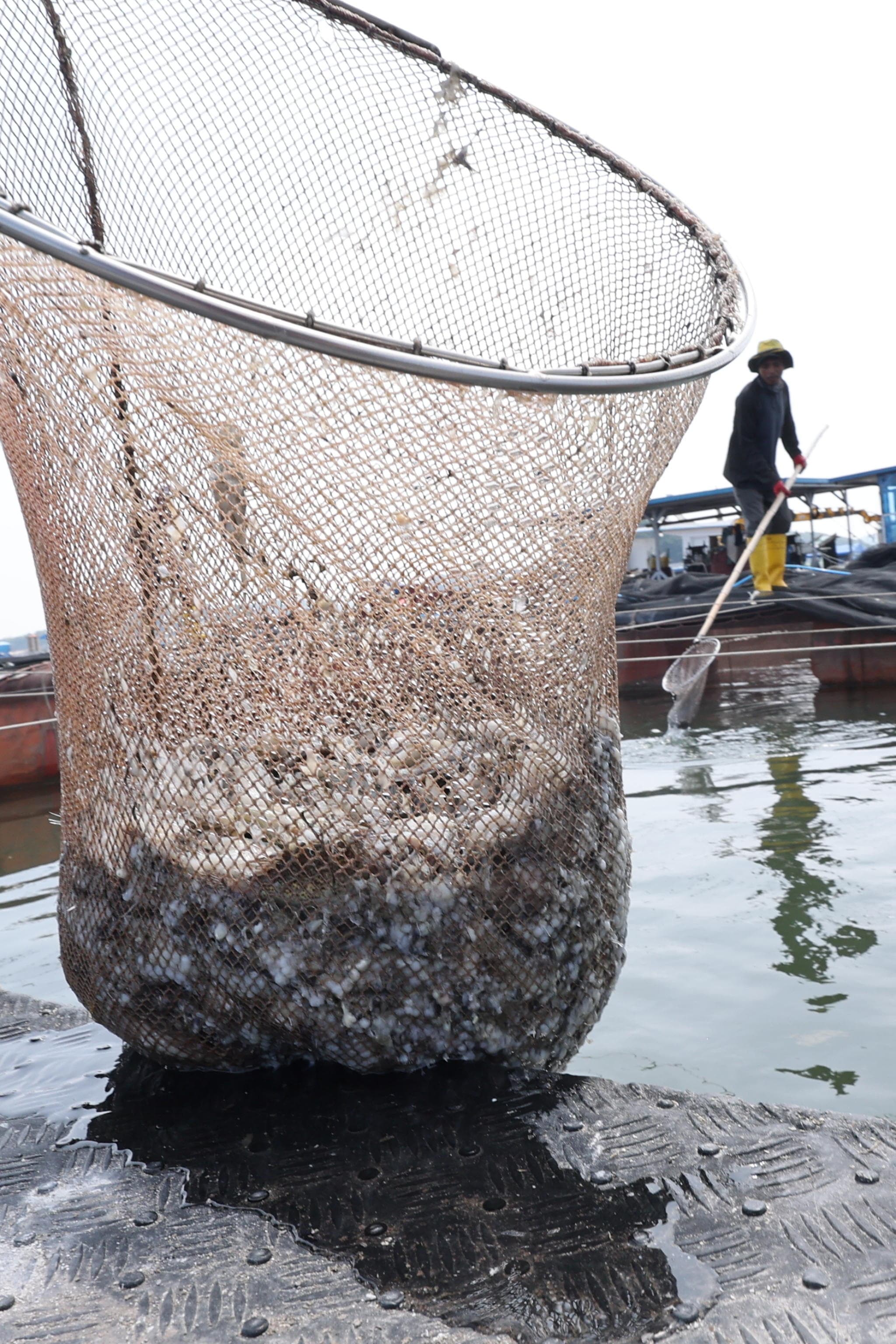
Pesci morti causa caldo

In Corea del Sud

epa13153333 Un pescatore raccoglie pesci morti da un allevamento ittico al largo di Taean, nella provincia di Chungcheong Meridionale, sulla costa occidentale della Corea del Sud, il 6 agosto 2026. Si ritiene che i pesci siano morti a causa delle elevate temperature dell’acqua, poiché la Corea del Sud è colpita da un’ondata di caldo. EPA/YONHAP SOUTH KOREA OUT

Against this backdrop of a high-pressure system, the only exceptions will be the usual afternoon heat-related thunderstorms.

Showers will remain confined almost exclusively to the Alpine circle and the Apennine ridge, whilst the coastlines and much of the lowlands will continue to enjoy uninterrupted sunshine throughout the day. The Ferragosto weekend will largely follow the same pattern, bringing stable weather and intense heat from north to south.

To see a potential shift in atmospheric circulation, we will have to wait until next week, specifically from 17–18 August (Monday and Tuesday).

The mathematical models are, in fact, beginning to show the first signs of a possible weakening of the high-pressure system, although the time frame involved calls for extreme caution before drawing any definitive conclusions.

However, the possible influx of cooler air into an overheated body of water would represent a potential cause for concern: the surface temperatures of the Italian seas have in fact already reached, and in some cases exceeded, the critical threshold of 30°C, recording values entirely comparable to those of tropical seas. This enormous amount of accumulated energy could, upon its first thermal encounter with colder upper-level currents, trigger particularly violent weather phenomena.

Copyright reserved ©
Loading...

Brand connect

Loading...

Newsletter

Notizie e approfondimenti sugli avvenimenti politici, economici e finanziari.

Iscriviti