Autumn, the super El Niño and the UN warning: the 1.5-degree limit is now set to be exceeded
There’s a huge thermal engine running in the Pacific. And someone has just turned the knob to the right

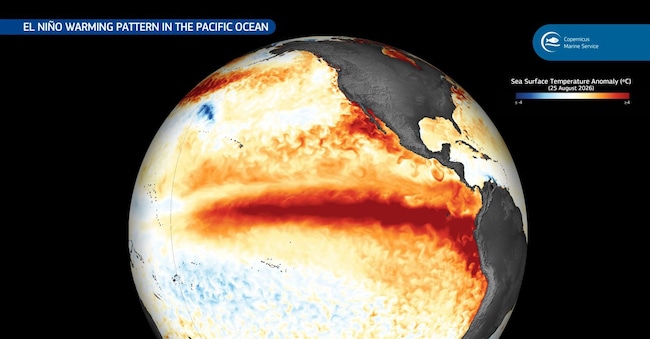
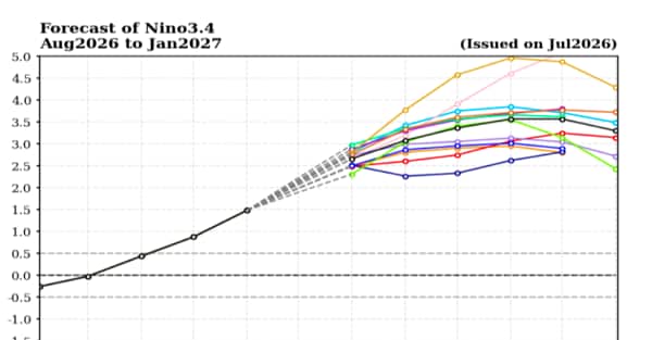
It’s called El Niño. It returned in 2026, is growing rapidly and, according to the World Meteorological Organisation, could become a very strong event during the northern hemisphere autumn. For the September–November quarter, models from the WMO indicate that in the central equatorial Pacific – specifically in the Niño 3.4 region, which is used as the main ‘thermometer’ for El Niño – sea surface temperatures could be, on average, up to around 3.6 °C warmer than normal. This is a very high anomaly over an enormous oceanic area, and is therefore capable of transferring large amounts of heat to the atmosphere. Furthermore, the phenomenon is expected to strengthen further towards November and December and is likely to remain active at least until February 2027.
Three and a half degrees may not seem like much.
In the equatorial Pacific, there is an enormous amount of energy. Think of the ocean as the planet’s thermal battery. The atmosphere weighs very little, whilst water weighs a great deal. If you heat a mass of water thousands of kilometres wide, that ‘battery’ begins to release energy into the air, altering rainfall, winds and the paths of weather systems across entire continents. That is why El Niño is now more relevant than ever to us all.
How does it work?
The mechanism is simple enough to explain and complicated enough to simulate.
Normally, the trade winds drive warm surface waters towards the western Pacific. Off the coast of South America, colder deep waters rise to the surface. During El Niño, this mechanism slows down or changes course. Gusts of westerly wind can push more warm water eastwards. The central and eastern Pacific warms up. The areas where warm air rises and where drier air sinks change. It is like moving the hob beneath a gigantic saucepan. Please note: El Niño does not determine whether it will rain in Milan on Tuesday afternoon. Instead, it alters the probabilities, shuffling the deck of cards from which the atmosphere will draw over the coming months.
And this is an important distinction.
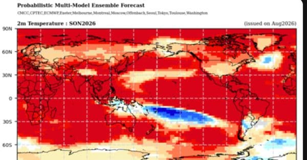
According to meteorologists, the effect of El Niño is less direct in Europe than in other parts of the world. Here, its influence is compounded by that of the Atlantic and by large-scale atmospheric movements. In practice, this can make the jet stream – the vast ‘ribbon’ of winds flowing at high altitude – more erratic. This can lead to prolonged periods of high pressure, interrupted by sudden cold snaps and spells of bad weather. The WMO forecasts above-average temperatures across large parts of the globe for September to November.