
The super El Niño is hitting an already warm planet. Here are the consequences
According to the analysis published in *Nature*, the event could far exceed all El Niño events observed over the last 150 years and, combined with global warming, push temperatures in 2027 towards a new record

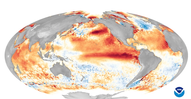
It’s called El Niño. It’s a natural phenomenon. It transfers heat from the ocean to the atmosphere, alters wind patterns and changes rainfall patterns. This year, it’s arriving on a planet that’s already hot. Too hot.
In an article published in *Nature*, oceanographer Carlos García-Soto describes a ‘thermally saturated’ Earth. The oceans have accumulated enormous amounts of heat. Ecosystems, agriculture and infrastructure are already under pressure. The risk therefore stems from the synchronisation of events: droughts, wildfires, floods, food crises and economic damage occurring all at once, without taking a number.
It is in this context that the latest article in *Nature* should be read; according to the article, the El Niño currently forming in the Pacific could become the most intense on record in at least 150 years.
What is El Niño?
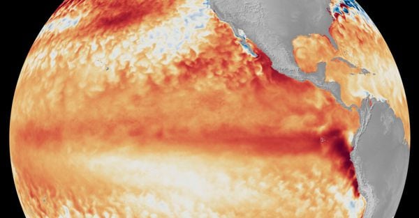
El Niño is a natural phenomenon. It existed long before cars and coal-fired power stations. It occurs on average every 2–7 years, altering wind patterns and leading to significant changes in the weather around the world, Under normal conditions, the trade winds push the warm waters of the equatorial Pacific westwards. When these winds slow down, the heat flows back towards the central and eastern Pacific.
What’s going on?
Climate simulations suggest that the surface temperature of the tropical Pacific could exceed the previous record – set during the 2015–2016 event – by around 0.8 °C. Eight tenths of a degree may not seem like much, but for the climate it is a huge shift. Imagine a tilted bath. The water pools on one side. Then the bath returns to level and the water quickly shifts in the opposite direction.


